Have you ever needed to check the exact legal boundaries of a property in California but didn’t want to spend hours driving down to a crowded county recorder’s office? Fortunately, you don’t have to. By using California GIS parcel maps online, you can access real time public property records, view precise tax lot dimensions, and audit zoning overlays right from your computer screen. Whether you are a real estate investor analyzing a potential flip, a homeowner planning a new fence line, or a developer running due diligence, understanding how to use Geographic Information Systems (GIS) is a vital skill. This comprehensive guide will show you how to locate official county land databases, manage interactive data overlays, and decode parcel data like a seasoned professional.
What is a California GIS Parcel Map?
A GIS (Geographic Information System) parcel map is a digital, data rich map that links geographic location details with official county assessor data. Unlike a static paper map, an interactive GIS platform combines multiple spatial data layers over a single geographic space. When you click on a piece of land using a parcel lookup tool, the system instantly cross references the underlying database to display ownership history, Assessor’s Parcel Numbers (APNs), assessed values, and property dimensions.
The California Spatial Data Infrastructure (CalSpatial)
At the state level, the California Geographic Information Association (CGIA) and the California Department of Technology manage high level spatial data policies through frameworks like CalSpatial. However, because property taxation and recording happen at the local level under California law, the actual structural ownership of cadastral data (property boundary mapping) is handled independently by California’s 58 counties.
State Portals vs. County GIS Viewers
While state agencies maintain large databases for environmental hazards and wildfire tracking, you must use county level GIS platforms to pull up actionable property information. Each county assessor’s office maintains its own customized public interface.
The table below highlights some of the most prominent official GIS platforms across California’s major economic regions.
| County | Official GIS Mapping Portal Name | Key Specialized Features |
| Los Angeles | LA County Net GIS / Portal | Assessor maps, historical aerial imagery overlays, and seismic fault line data. |
| San Diego | SanGIS Interactive Map | Combined city/county data layers, regional ecology data, and topography contours. |
| Orange County | OC GIS Open Data Portal | High resolution lot lines, public works infrastructure overlays, and school district maps. |
| Riverside | Map My County (Rivet) | Custom buffer zone creators, agricultural designations, and comprehensive fire hazard zones. |
Step by Step Guide, How to Find and Read Any California Parcel Online
Ready to look up a property? Follow this straightforward, professional workflow to access official county data systems and analyze your target parcel without any common technical errors.
Step 1. Gather Your Target Property Identifiers
Before loading any maps, make sure you have the exact street address or the 10 to 12 digit Assessor’s Parcel Number (APN). You can easily pull the APN directly from a recent property tax bill or mortgage document if needed.
Step 2. Access the Designated County Assessor Viewer
Go directly to the official GIS map portal for the county where the property is located (e.g., LA County’s Net GIS or SanGIS for San Diego). Avoid third party real estate platforms, as their copied boundary data can often be delayed or inaccurate.
Step 3. Input Search Parameters into the Lookup Tool
Locate the search bar within the GIS interface (usually positioned in the upper left or upper right corner). Input your APN or address. The digital cartography engine will automatically center the screen over your target lot boundaries.
Step 4. Activate and Adjust Your Spatial Data Layers
Open the “Layers” menu panel. Toggle on the specific data sets you need to review. For general property reviews, always check the lot boundaries, aerial imagery, and zoning overlays.
Step 5. Review the Asset Attribute Summary Window
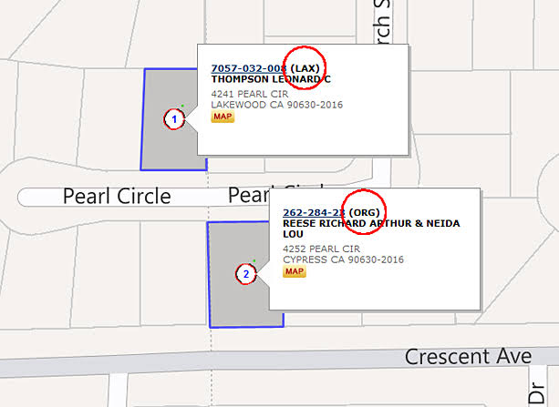
Click directly inside the highlighted parcel boundaries. A data popup window will appear on your screen, revealing the official land acreage, construction year, square footage, and current tax assessments.
How to Interpret Map Data, Lot Boundaries vs Easements
When reading digital maps, you must look closely at how lines are drawn. Misinterpreting a line on a GIS map is a frequent mistake that can cause major issues during construction or purchasing.
- Solid Parcel Lines
These dark, continuous boundaries define the primary legal edges of the property lot as recorded by the county surveyor. - Dotted or Dashed Lines
These symbols typically represent internal property features, such as utility easements, public access rights of way, or structural building setback limits. - Aerial Imagery Calibration
Keep in mind that satellite imagery grids can sometimes shift by a few inches or feet depending on camera angles. Never rely solely on a visual satellite line overlay to settle a legal boundary dispute. For definitive legal confirmation, you must hire a licensed land surveyor to complete an official physical staking of the property lines.
Advanced GIS Analysis, Utilizing Overlay Features
The true power of California GIS parcel maps online lies in their advanced data layers. Professional real estate developers use these map tools to identify invisible risks and opportunities before committing capital.
Environmental Hazard Overlays
California is highly prone to natural disasters. Most official county GIS portals allow you to toggle on state verified hazard layers, including.
- Alquist Priolo Earthquake Fault Zones
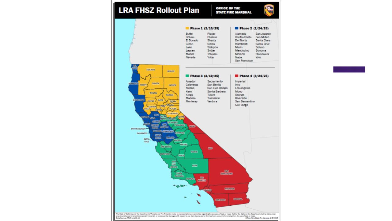
Highlights strict surface fault rupture hazards where building human habitations is legally restricted. - Cal Fire Very High Fire Hazard Severity Zones (VHFHSZ)
Indicates properties subject to strict state building codes and mandatory wildfire defense guidelines.
Topography and Infrastructure Layers
By toggling the digital elevation contours (frequently derived from aerial LiDAR scanning), you can easily judge the slope and grade of a piece of land without visiting the site. Furthermore, public infrastructure layers can reveal hidden water mains, storm drains, and sewer hookup paths that are critical for budgeting any new construction project.
Key Takeaways California GIS Tools
Using digital mapping platforms saves time and gives you direct access to the same records used by government offices. By learning to look up parcel data, select mapping layers, and verify property facts across official county channels, you can protect your real estate investments and quickly spot site issues. Always use verified county portals alongside local municipal codes to ensure your mapping research is completely accurate.
FAQs
Are California GIS parcel maps online free to use?
Yes. Every county assessor’s office in California provides free public access to their interactive web GIS mapping viewers and parcel lookup utilities.
Can I find the current owner’s name on a public GIS map?
Some rural California counties display owner names directly in parcel summaries, but major urban counties often hide ownership names online to protect public privacy.
How accurate are the property lines shown on county GIS maps?
GIS maps are designed for general planning and informational purposes only. They are highly accurate but cannot legally replace a physical survey by a licensed land professional.
What should I do if a GIS map shows my house crossing a property line?
Do not panic. Satellite map layers can occasionally experience slight alignment shifts. You will need to order a formal physical property survey to establish the true legal boundaries.
What does the term “cadastral data” mean in GIS mapping?
Cadastral data refers specifically to the public geographic registry of a country or region’s land parcels, including detailed lot boundaries, acreage statistics, and ownership identifiers.
Why won’t my address load in the county parcel lookup tool?
If an address fails to load, try searching by the unique Assessor’s Parcel Number (APN) instead, or look for alternative historical addresses linked to that plot.
Can I access historical aerial imagery on California GIS portals?
Yes. Advanced county platforms like LA County Net GIS allow users to toggle historical map layers to see how a lot looked decades ago.
What is a GIS map layer?
A layer is an isolated visual dataset such as zoning, flood hazards, or water lines that you can stack on top of a base map for analysis.
How often do California counties update their online parcel maps?
Most modern county IT departments refresh their online GIS records and database attributes on a weekly or monthly basis as new property deeds are processed.
Can I download raw GIS boundary files from county portals?
Yes. Many California counties offer public “Open Data” web portals where developers and engineers can freely download raw GIS shapefiles (.SHP) for advanced analysis.