You can change your house, but you can never change your neighborhood! When you buy California real estate, you aren’t just financing four walls; you are investing in a local school district, community demographics, and a specific lifestyle. While a kitchen can be remodeled, you cannot relocate a high crime street or upgrade local amenities on your own. To protect your hard earned money and ensure long term property value growth, you must verify the area using official, factual public datasets.

1. School District Ratings, The Foundation of Property Value Growth
If you have a family or care about future resale value, evaluating local education quality is non negotiable. In California, neighborhoods tied to high performing schools historically maintain the strongest economic stability and steady home price appreciation. Instead of relying on commercial real estate sites, look directly at the state’s official education databases.
- California School Dashboard
Maintained by the California Department of Education, this portal provides real time data on graduation rates, college readiness, chronic absenteeism, and test scores for every public school. - Ed Data
A collaborative partnership that offers comprehensive financial, demographic, and performance histories for California school districts.
When analyzing a school district, do not just look at a single score. Track the academic performance trends over a three year period and review the student to teacher ratio to ensure local students receive adequate classroom attention.
2. Crime Statistics Lookup, Verifying Real World Safety
Safety is a critical element of any neighborhood research process. While a street might look quiet during an afternoon open house, public records reveal the true, long term security metrics of the community.
Official Crime Portals
- Local Police Department Maps
Major metropolitan agencies such as the LAPD, SFPD, or San Diego Police Department partner with platforms like Crime Mapping or Crime Graphics. Enter your prospective address to filter incident reports from the past 90 days. - California Department of Justice (DOJ)
Use the state’s official Megan’s Law Database to view geographic profiles and track registered offenders within a specific radius of the property.
Expert Tip. Distinguish between property crimes (like vehicular theft) and violent crimes. Also, take note of the neighborhood’s proximity to local police precincts, which directly impacts emergency response times.
3. Walkability Score & Local Amenities, Evaluating Daily Lifestyle
A sustainable neighborhood provides easy access to daily necessities without forcing you to sit in California traffic for every minor errand. Proximity to parks, grocery stores, and medical facilities dictates your everyday quality of life. To measure this, check the neighborhood’s walkability score via independent transit indexes to determine if the area is a “Walker’s Paradise” or entirely car dependent. Additionally, review the City General Plan. Every California municipality hosts a long term development document on its official website. Reviewing this plan ensures you won’t be caught off guard by future commercial zoning, public transit expansions, or major construction projects near your property line.
4. Community Demographics & Economic Stability
An area’s underlying economic health is an excellent indicator of how well it will withstand real estate market downturns. Evaluating local employment and demographic shifts helps ensure you are moving into an economically thriving environment. The U.S. Census Bureau (QuickFacts California) is the most reliable tool for this step. By filtering data down to the specific city or ZIP code level, you can review essential data points, including.
- Median household income levels
- Local employment and unemployment rates
- Educational attainment percentages
California Neighborhood Research Matrix
To help streamline your due diligence, utilize this comprehensive tracking matrix mapped directly to verified, high authority public data sources.
| Research Category | Primary Indicator | Official Verification Source |
| Education Quality | Test Trends, Graduation Rates | California School Dashboard (cde.ca.gov) |
| Safety & Security | Incident Logs, Offender Tracking | Local Police Maps & California DOJ Portal |
| Economic Health | Median Income, Employment Data | U.S. Census Bureau (census.gov) |
| Property Trends | Historical Valuations, Tax Growth | County Assessor Portals & FHFA HPI |
| Lifestyle & Transit | Pedestrian Access, Future Zoning | Walk Score Index & City General Plan Docs |
5. Environmental Hazards & Natural Disaster Risks in CA
California’s unique geography means environmental risk assessment is a mandatory step in your research workflow. Natural hazards can profoundly impact your safety and drive up your mandatory insurance premiums.
Critical Safety Portals to Review
- Wildfire Risk
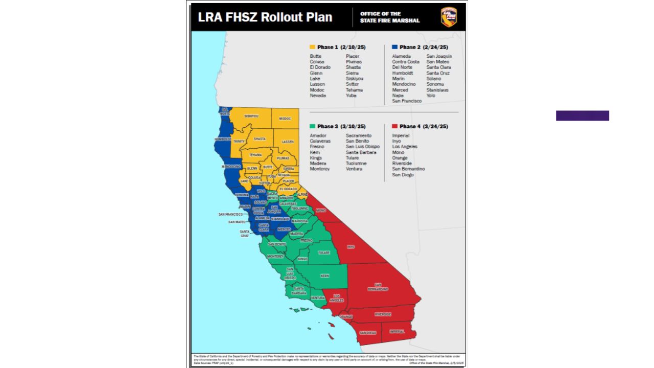
Visit the California Department of Forestry and Fire Protection (CAL FIRE) mapping tools to see if the parcel sits inside a designated “High Fire Hazard Severity Zone.” - Seismic Activity
Consult the California Geological Survey (CGS) interactive maps to identify local fault lines designated under the Alquist Priolo Earthquake Fault Zoning Act. - Flood Zones
Input the address into the FEMA Flood Map Service Center to verify its exact flood zone designation (e.g., Zone A, V, or X), which dictates whether you will be required to carry costly secondary flood insurance policies.
6. Step by Step Action Plan for Homebuyers
Before submitting an official offer on a California property, complete this step by step checklist using the public datasets outlined above.
- Step 1. Look up the assigned local schools on the California School Dashboard to verify multi year academic growth.
- Step 2. Run the address through the Local Police Department’s crime mapping interface to analyze incident patterns over the last quarter.
- Step 3. Use the U.S. Census Bureau portal to confirm that the local median household income supports stable property values.
- Step 4. Cross reference the property’s parcel history on the local County Assessor’s website to review historical tax assessment growth.
- Step 5. Conduct physical site visits during disparate hours, such as weekday morning commute windows and weekend nights to accurately gauge localized traffic, parking availability, and ambient noise levels.
Final Expert Verdict
Smart real estate investing requires replacing emotion with data. Prioritizing California neighborhood research through public datasets protects your capital. By auditing school district ratings, verifying a crime statistics lookup, and analyzing property value growth, you insulate your family from costly environmental and financial risks. Never rush the due diligence process, verify local data before signing.
FAQs
How do I check California school district ratings officially?
Visit the official California School Dashboard (cde.ca.gov) to check state verified test scores, graduation rates, and progress metrics for any public school district.
Where can I find a reliable crime statistics lookup for CA?
Use CrimeMapping or CrimeGraphics to view live incident maps from local police departments, and verify the California DOJ Megan’s Law database.
How does walkability score affect property value growth?
Properties with high walkability scores near local amenities command premium prices and show stronger long term property value growth due to high buyer demand.
Where can I verify community demographics in California?
The U.S. Census Bureau QuickFacts portal provides official data on median household income, employment rates, and education levels for any California ZIP code.
How do I check California wildfire and environmental risks?
Cross reference the property address with CAL FIRE hazard maps to see if the home sits inside a designated High Fire Hazard Severity Zone.
Where can I find historical property value growth data?
Check the local County Assessor’s office portal to review historical tax assessments, or use the Federal Housing Finance Agency (FHFA) House Price Index.
What is the Alquist Priolo Act in California real estate?
It is a California law requiring disclosure of earthquake fault lines. Verify these risks using the California Geological Survey interactive mapping tools.
Why should I review a city’s General Plan?
The City General Plan reveals future zoning changes, new local amenities, and public transit expansions that will directly impact your neighborhood’s future value.
How do FEMA flood zones impact California homeowners?
Properties in high risk FEMA flood zones require mandatory flood insurance, which adds significant recurring costs to your monthly mortgage payment obligations.
Can neighborhood crime statistics lookup impact home insurance?
Yes, high localized crime rates or property theft trends can increase your homeowners insurance premiums or limit your coverage options with major carriers.