Butte County CA Property Appraiser, Search Your Record Lookup
In Butte County California 102,500 parcels, You Can Search Property Record With Parcel number, owner name, or address. If You Want to search With Parcel ID, enter the (example: 200401302). Get property, tax and owner details.
California State Property Appraiser Search, Access Your Record
California State has more than 12.1 Million parcels, You Can Search Property Record With Parcel number / AIN, ZIP Code, or with address. Example: 2004013020
California Property Search
| Zip Code | Parcel Number (APN) | Assessor ID | Roll Year | Tax Rate Area Code | Property Location | Property Use Type | Year Built | Square Footage | Number Of Bedrooms | Number Of Bathrooms | Number Of Units | Land Value | Improvement Value | Total Value | Total Exemption | Taxable Value | Parcel Legal Description | Street | City | AIN |
|---|
Property Tax Calculator
Transfer Fee Calculator
Property Tax Rates
Find Your County Map
County Property News
In Butte County, California, the Assessor’s Office, led by Diane Brown, manages and updates comprehensive parcel data for public use. The county currently tracks 102,500 parcels and 94,600 matched buildings, using property data and mapping techniques across the region. Property address records were recently updated, identifying 118,400 total matched addresses, including 15,200 secondary matched address parcels. The Assessor has also standardized zoning data for 102,500 parcels across all towns, supporting accurate property assessments, parcel records, and tax roll information.
Butte County CA ZIP Codes & Cities
Find homes in popular Butte County CA ZIP codes or search by city, neighborhood, and region. Browse all ZIP codes and communities across Butte County California.
About Butte County CA ZIP Codes
Butte County California includes popular communities such as Chico, Oroville, Paradise, Gridley, Biggs, Durham, and Magalia. This searchable ZIP code directory helps residents, businesses, home buyers, and visitors quickly explore postal areas across Butte County.
Butte County, California Property Overview 2026
In Butte County, California, there are 81,200 residential properties and 4,850 commercial properties. The average single family home is 47 years old with 1,676 sq. ft. In 2026, 405 homes sold, while 1.02% are seriously underwater. The county sees 3,107 annual sales, 39.32% rich homes, 0.79% effective tax, and 49 foreclosures.
Residential Properties
81,200
Commercial Properties
Avg. Home Age Single Family
Avg. Square Feet Single Family
Residential Sales 2026
Homes Seriously Underwater
Residential Sales past year
Rich Homes percentage
Effective 2026 Property Tax
Total Foreclosure Filings 2025
49 Year to date
Top Cities in Butte County
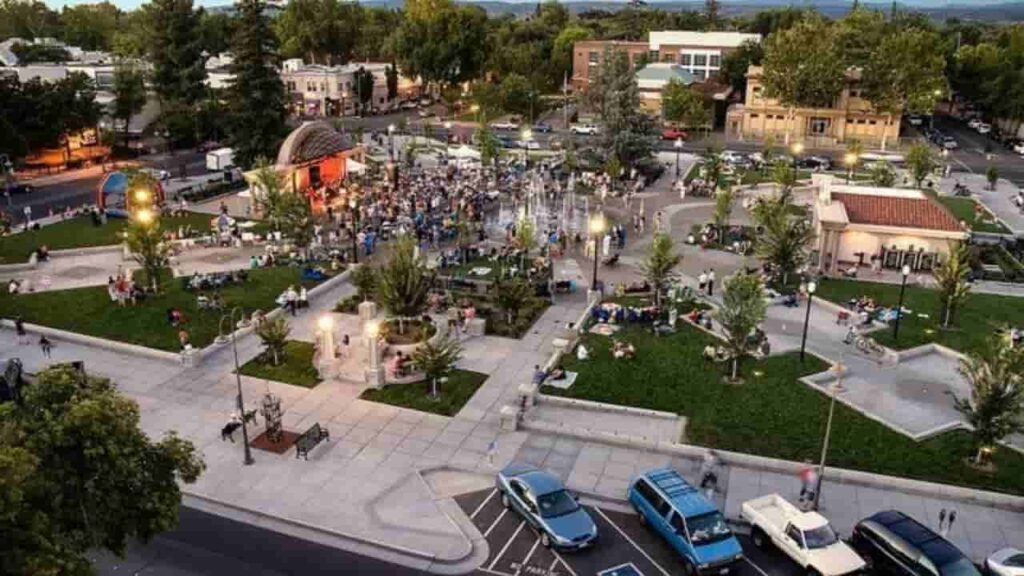
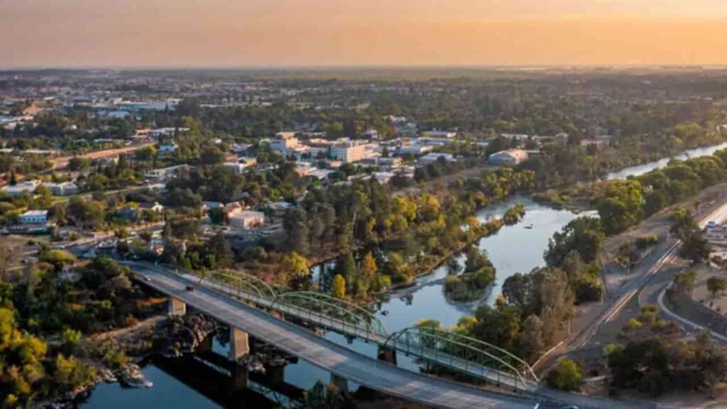
The most popular cities in Butte County, California are Chico, Oroville, and Paradise. Chico is the largest city, home to California State University, Chico, with a vibrant downtown and diverse neighborhoods. Oroville, the county seat, is known for the Oroville Dam and its role as a charter city. Paradise is a scenic residential community in the foothills. Together, these cities serve as the county’s primary residential and economic hubs, contributing significantly to property assessments, zoning management, and overall parcel data maintained by the Butte County Assessor’s Office.
Chico City
35,153 Parcels
Oroville City
55,566 parcels

11,555 Parcels
Butte County CA Property Search Tool Has 4 Best Method
Our Butte County, California Property Search Tool makes it simple to access property records online for free. You can search by owner name, parcel number (PIN), property address, or city name. Quickly view ownership details, tax information, sales history, and complete property data in just a few clicks.
Search By Owner Name
You Can Use Owner name For Property Search In Butte County CA.
Search By Address
You Can Also search Property Info with address in Butte County CA.
Search By Parcel PIN
Use Parcel Number For Exact Search In Butte County CA.
Search By City Name
If You Dont't have any other Option, search With City Name, Use in Address
Butte County CA property Search Tool Provide Information
Our Butte County, California Property Search Tool provides fast and comprehensive access to property records. Easily search by owner name, parcel number (PIN), or property address to view detailed ownership information, tax records, land values, and official county assessments. Get accurate, up to date property insights for informed real estate research in Butte County.
Parcel Number
The Parcel Number (Parcel ID) is the unique identifier assigned by Butte County for property tracking, tax assessments, and official records. This is the most accurate way to locate a specific property and access detailed ownership and tax information.
Owner Name
The Owner Name field lists the legally recorded property owner in Butte County public records. It verifies ownership, confirms title details, and identifies parties responsible for property taxes or legal matters.
Property Address
The Property Address indicates the physical location of the property in Butte County, California. It ensures accurate property identification, supports mailing verification, and delivers reliable search results for buyers, investors, and researchers.
Tax District
The Tax District identifies the local taxing authority for the property. It determines applicable millage rates, assessments, and jurisdiction-specific taxes affecting annual obligations.
Property Use Code
The Property Use Code shows how the property is classified, such as residential, commercial, or vacant land. This classification affects taxation, zoning regulations, and market value assessments.
Legal Description
The Legal Description provides the officially recorded subdivision, lot, and block details. It is essential for legal documentation, title verification, and precise property boundary identification.
Tax Book
The Tax Book refers to the official county record where property tax information is documented, helping trace historical tax data and verify past assessments.
Tax Page
The Tax Page shows the exact page in county tax records where the property is listed, allowing faster referencing for legal, professional, or investment research.
Annual Property Taxes
This section displays the total assessed property taxes owed annually, helping homeowners, investors, and buyers understand financial obligations associated with the property.
ZIP Code
The ZIP Code identifies the postal area of the property in Butte County. It supports demographic research, market analysis, and precise geographic identification.
Owner City
Owner City displays the registered city of the property owner’s mailing address, helping determine if the property is owner-occupied or investor-owned.
Property City
Property City identifies the municipality where the property is physically located, affecting local zoning, taxes, and community regulations.
Land Value
Land Value represents the county-assessed value of the land only, excluding any structures. It is key for property tax calculations and investment evaluation.
Taxable Value
Taxable Value shows the portion of the property’s assessed value subject to taxation after exemptions, directly impacting annual property tax charges.
Stated Area (Acres)
Stated Area indicates the total land size in acres, helping buyers, developers, and investors evaluate lot dimensions, development potential, and overall property scale.
Butte County Property & Demographic Data
Butte County city and community-level property and tax data, including estimated parcels, population, land area, millage rate equivalent, and median tax bills, providing a clear snapshot of property distribution and local taxation across the county. In Butte County, property taxes follow California Proposition 13: 1% of assessed value plus voter-approved local bonds. The "Millage Rate Equivalent" represents the tax percentage multiplied by 10 (e.g., 1.2% = 12.0 mills).
| City / Community | Total Parcels (Est.) | Total Population | Area (Sq Mi) | Millage Rate (Equiv.) | Median Tax Bill (Est.) |
|---|---|---|---|---|---|
| Chico | 32,500 | 102,400 | 33.3 | 11.5 – 12.2 | $5,250 |
| Oroville | 8,200 | 20,400 | 13.1 | 11.8 – 13.5 | $3,100 |
| Paradise | 10,800 | 9,800* | 18.3 | 11.0 – 12.5 | $3,800 |
| Gridley | 2,400 | 7,450 | 2.1 | 11.2 – 12.0 | $3,400 |
| Biggs | 650 | 2,050 | 0.6 | 11.0 – 11.8 | $2,950 |
| Magalia | 8,500 | 11,200 | 14.1 | 10.5 – 11.2 | $2,950 |
| Durham | 2,800 | 2,650 | 82.2 | 10.8 – 11.5 | $6,100 |
| Palermo | 2,200 | 5,400 | 29.1 | 11.2 – 12.0 | $2,600 |
| Thermalito | 2,100 | 6,800 | 12.8 | 11.5 – 12.5 | $2,850 |
| Forest Ranch | 1,450 | 1,150 | 13.9 | 10.2 – 10.8 | $4,800 |
| Richvale | 450 | 240 | 0.9 | 10.5 – 11.0 | $5,400 |
FAQs
How can I search for property records in Butte County?
You can use the Butte County Property Search Tool to look up property records by owner name, parcel number (PIN), property address, or city/community name. The tool provides instant access to ownership details, tax records, and property information.
What does “Millage Rate Equivalent” mean in Butte County?
In Butte County, property taxes follow California Proposition 13: a 1% base tax plus voter-approved local bonds. The Millage Rate Equivalent in our table shows the total tax rate multiplied by 10, helping users quickly compare city and community tax levels.
Is the property information on the tool free?
Yes! All property records accessed through our Butte County Property Search Tool are completely free to use. You can view ownership, tax data, and other property details without any subscription or payment.
Are the property and tax data up to date?
All property data and tax estimates are based on 2026 projections from the Butte County Assessor’s Office. This includes parcel counts, population, land area, and median tax bills, ensuring accurate insights for buyers, investors, and researchers.
Can I view property details for unincorporated communities?
Yes. The tool covers both cities and unincorporated communities in Butte County, including Magalia, Durham, Palermo, Thermalito, Forest Ranch, and Richvale. You can access parcel data, population estimates, land area, and median tax bills for each area.