
Shasta County CA Property Appraiser, Search Your Record Lookup
In Shasta County California 101,501 parcels, You Can Search Property Record With Parcel number, owner name, or address. If You Want to search With Parcel ID, enter the (example: 2004013020). Get property, tax and owner details.
California State Property Appraiser Search, Access Your Record
California State has more than 12.1 Million parcels, You Can Search Property Record With Parcel number / AIN, ZIP Code, or with address. Example: 2004013020
California Property Search
| Zip Code | Parcel Number (APN) | Assessor ID | Roll Year | Tax Rate Area Code | Property Location | Property Use Type | Year Built | Square Footage | Number Of Bedrooms | Number Of Bathrooms | Number Of Units | Land Value | Improvement Value | Total Value | Total Exemption | Taxable Value | Parcel Legal Description | Street | City | AIN |
|---|
Property Tax Calculator

Transfer Fee Calculator
Property Tax Rates

Find Your County Map

County Property News
Shasta County Property Search is essential for buyers, investors, and researchers exploring real estate trends in Shasta County. The Shasta County Assessor Recorder oversees valuation and records for taxable property. With 101,501 total parcels, 124,532 matched buildings, and 119,744 addresses, the county shows strong data coverage. Annual roll growth reached 4.14%, reflecting steady market expansion and promising future real estate and investment potential across residential and multi-unit developments.
Shasta County CA ZIP Codes
Explore all ZIP codes in Shasta County California with city names and locations.
Shasta County, California Property Overview 2026
In Shasta County, the property market remains stable with strong residential dominance. There are 64,123 residential and 6,075 commercial properties, supported by an average home age of 43 years and typical size of 1,681 sq. ft. Year to date residential sales reached 330, with 2,405 recorded over the past year. The effective property tax rate is 0.77%, while only 0.85% of homes are underwater, indicating healthy equity and long term investment potential. The Shasta County Assessor-Recorder continues to oversee accurate valuation and property records across the county.
Residential Properties
64,123
Commercial Properties
Avg. Home Age Single Family
Avg. Square Feet Single Family
Residential Sales 2026
Homes Seriously Underwater
Residential Sales past year
Rich Homes percentage
Effective 2026 Property Tax
Total Foreclosure Filings
54 Year to date
Top Cities in Shasta County
The most popular cities in Shasta County include Redding, Anderson, and Shasta Lake, serving as key residential and commercial hubs. Burney, Weaverville, Fall River Mills, and Montgomery Creek offer small-town living, outdoor recreation, and scenic surroundings near forests, rivers, and mountain regions. Together, these communities support local housing demand, property assessments, and steady regional growth driven by lifestyle appeal, tourism, and expanding amenities across the county.
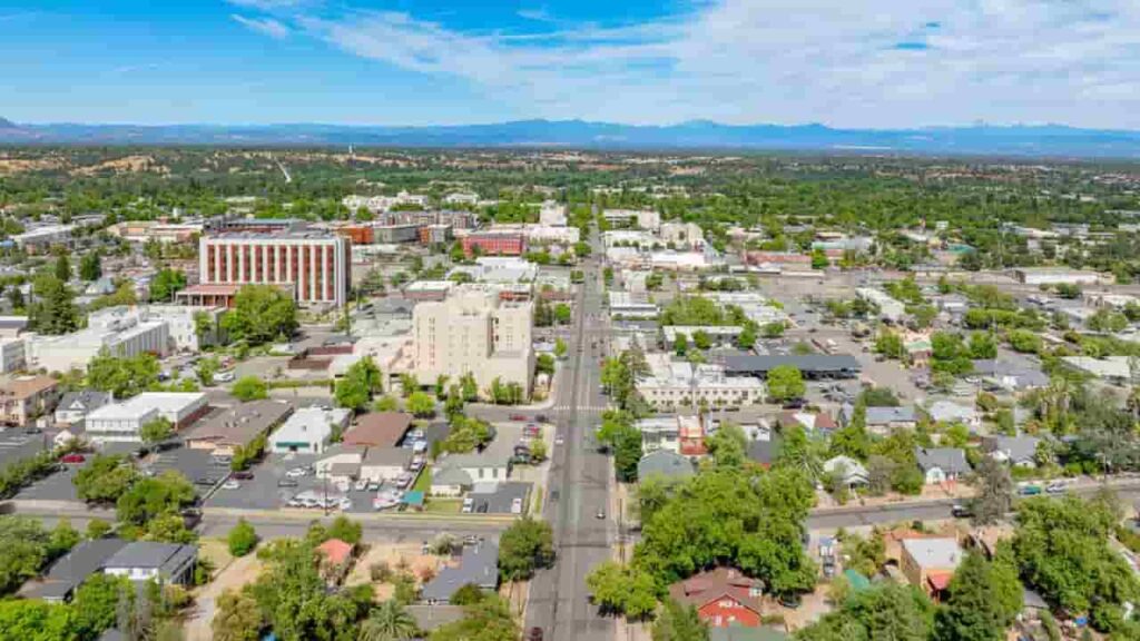
Redding City
41,693 Parcels

Anderson City
8,777 parcels

192 Parcels
Shasta County CA Property Search Tool Has 4 Best Method
Our Shasta County Property Search Tool allows you to quickly and easily access property records online for free. Search by owner name, parcel number (APN), property address, or city to instantly view ownership details, tax information, sales history, and comprehensive property data in just a few clicks.
Search By Owner Name
You Can Use Owner name For Property Search In Shasta County California.
Search By Address
You Can Also search Property Info with address in Shasta County California.
Search By Parcel PIN
Use Parcel Number For Exact Search In Shasta County California.
Search By City Name
If You Dont't have any other Option, search With City Name, Use in Address
Shasta County CA property Search Tool Provide Information
The Shasta County Property Search Tool provides instant access to complete property information. Easily search by owner name, APN (Assessor’s Parcel Number), or property address to explore ownership details, tax records, assessed values, sales history, and official county data, everything you need for reliable, informed real estate decisions.
Zip Code
The Zip codes in Shasta County help identify precise property locations, supporting demographic analysis, real estate research, zoning clarity, and efficient geographic property searches online tools.
APN )
The APN (Assessor’s Parcel Number) in Shasta County is a unique identifier assigned by the Assessor Recorder office to track each parcel for property taxes, assessments, ownership records, and accurate real estate search and management.
Assessor ID
The Assessor ID in Shasta County is a reference used to connect properties with official county records, ensuring accurate property tracking, tax assessments, and reliable ownership verification for research and real estate transactions.
Roll Year
The Roll Year in Shasta County indicates the fiscal year of a property’s assessment, helping track valuation changes over time and determine accurate property tax obligations and trends.
Tax Rate Area Code
The Tax Rate Area Code in Shasta County identifies the local taxing jurisdiction, determining applicable property tax rates based on city boundaries, school districts, and special districts for accurate tax calculation and allocation.
Property Location
The Property Location in Shasta County refers to the physical address or geographic position of a property, ensuring accurate identification, supporting property searches, buyer decisions, and official county records management.
Property Use Type
The Property Use Type in Shasta County indicates how a property is classified, such as residential, commercial, or industrial, influencing zoning regulations, tax calculations, and overall property assessment for accurate county records and planning.
Year Built
The Year Built in Shasta County records the construction year of a property’s primary structure, impacting valuation, depreciation, insurance considerations, and overall market assessment for buyers, sellers, and county property records.
Square Footage
The Square Footage in Shasta County represents the total living area of a property, helping estimate market value, compare listings, and support planning for renovations, appraisals, and real estate decision-making.
Number of Bedrooms
The Number of Bedrooms in Shasta County reflects the total sleeping spaces in a residential property, helping buyers evaluate suitability, supporting appraisers in valuation, and assisting assessors in market analysis and property comparisons.
Number of Bathrooms
The Number of Bathrooms in Shasta County indicates the total bathrooms in a property, playing a key role in usability, buyer preferences, and comparative market analysis for accurate valuation and real estate decision-making.
Number of Units
The Number of Units in Shasta County specifies how many separate living or commercial spaces exist on a property, influencing rental income potential, property valuation, zoning classification, and taxation for accurate real estate analysis.
Land Value
The Land Value in Shasta County represents the county-assessed worth of the land excluding any structures, playing a key role in property tax calculations, valuation breakdown, and long-term real estate investment analysis.
Improvement Value
The Improvement Value in Shasta County measures the assessed value of buildings or structures on a property, excluding land, and contributes to determining total assessed value, property taxes, and overall market valuation for real estate analysis.
Total Value
The Total Value in Shasta County represents the combined assessed worth of land and improvements on a property, forming the basis for property tax calculations, valuation reports, and investment decisions in real estate analysis.
Total Exemption
The Total Exemption in Shasta County indicates deductions applied to a property’s taxable value, such as homeowner or senior exemptions, helping reduce overall property tax obligations and improve affordability in real estate ownership.
Taxable Value
The Taxable Value in Shasta County is the portion of a property’s assessed value that remains subject to county taxation after exemptions are applied, forming the basis for calculating annual property tax obligations and financial planning.
Parcel Legal Description
The Parcel Legal Description in Shasta County provides official boundary details, including lot, block, or subdivision information, essential for legal identification, property surveys, ownership verification, and accurate county recordkeeping.
Street
The Street in Shasta County identifies the property’s exact street location, supporting navigation, mail delivery, and accurate property searches for buyers, researchers, and county record management.
City
The City in Shasta County specifies the municipality where a property is located, influencing local zoning laws, tax rates, community regulations, and overall property classification within county records and real estate analysis.
Shasta County Property & Demographic Data (2026)
Shasta County property and city level data includes estimated parcels, population, land area, effective tax rates, and median tax bills. In 2026, unlike millage based systems, Shasta County follows Proposition 13, where the base property tax is 1% of assessed value, plus small local voter-approved bonds (typically 0.05% to 0.20%). This results in an effective tax rate of approximately 1.05% to 1.20%, providing a clear and predictable taxation structure for property owners and investors.
| City / CDP | Total Parcels (Est.) | Total Population | Area (sq mi) | Effective Tax Rate | Median Tax Bill (Est.) |
|---|---|---|---|---|---|
| Redding | 38,500 | 92,604 | 61.2 | 1.15% | $4,213 |
| Anderson | 4,200 | 11,141 | 6.6 | 1.12% | $3,100 |
| Shasta Lake | 4,100 | 10,133 | 10.9 | 1.18% | $3,450 |
| Bella Vista | 1,100 | 2,781 | 4.3 | 1.07% | $4,200 |
| Big Bend | 180 | 102 | 5.8 | 1.05% | $1,800 |
| Burney | 1,800 | 3,024 | 5.4 | 1.05% | $1,950 |
| Cassel | 220 | 207 | 3.2 | 1.05% | $2,100 |
| Castella | 210 | 240 | 2.1 | 1.05% | $1,900 |
| Fall River Mills | 950 | 545 | 4.8 | 1.05% | $2,400 |
| French Gulch | 350 | 346 | 12.4 | 1.05% | $2,200 |
| Hat Creek | 310 | 309 | 50.1 | 1.05% | $2,800 |
| Igo | 190 | 153 | 6.5 | 1.05% | $2,750 |
| Lakehead | 750 | 461 | 5.2 | 1.05% | $2,600 |
| Millville | 300 | 727 | 8.2 | 1.05% | $4,500 |
| Montgomery Creek | 140 | 163 | 3.3 | 1.05% | $1,750 |
| Oak Run | 420 | 750 | 45.2 | 1.05% | $3,100 |
| Old Station | 160 | 51 | 2.2 | 1.05% | $2,500 |
| Palo Cedro | 1,650 | 1,241 | 3.8 | 1.07% | $5,800 |
| Round Mountain | 180 | 155 | 1.7 | 1.05% | $1,850 |
| Shasta (Old Shasta) | 400 | 1,771 | 11.0 | 1.05% | $3,600 |
| Shingletown | 2,200 | 2,125 | 14.1 | 1.05% | $3,150 |
| Whiskeytown | 85 | 30 | 1.2 | 1.05% | $3,900 |
| Whitmore | 250 | 240 | 4.1 | 1.05% | $2,900 |
FAQs
What is Shasta County Property Search used for?
It is used to look up property details such as ownership, parcel information, assessed values, taxes, and location records within Shasta County.
Who manages property records in Shasta County?
The Shasta County Assessor-Recorder is responsible for maintaining property assessments, parcel records, and taxable value information.
How can I find my property’s APN or parcel number?
You can search using address, owner name, or map tools in the property search system to retrieve the APN, which uniquely identifies your parcel in county records.
What information can I access through a property search?
Users can view property location, assessed value, land and improvement details, tax rate area, exemptions, and historical assessment data.
Is Shasta County property data updated regularly?
Yes, property data is updated annually and reflects changes such as ownership transfers, new construction, and reassessments conducted by the Assessor-Recorder’s office.