
Alameda County California Property Appraiser, Search Your Record Lookup
In Alameda County California 472,000+ parcels, You Can Search Property Record With Parcel number, owner name, or address. If You Want to search With Parcel ID, enter the (example: 2004013020). Get property, tax and owner details.
California State Property Appraiser Search, Access Your Record
California State has more than 12.1 Million parcels, You Can Search Property Record With Parcel number / AIN, ZIP Code, or with address. Example: 2004013020
California Property Search
| Zip Code | Parcel Number (APN) | Assessor ID | Roll Year | Tax Rate Area Code | Property Location | Property Use Type | Year Built | Square Footage | Number Of Bedrooms | Number Of Bathrooms | Number Of Units | Land Value | Improvement Value | Total Value | Total Exemption | Taxable Value | Parcel Legal Description | Street | City | AIN |
|---|
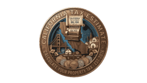
Property Tax Calculator
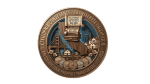
Transfer Fee Calculator
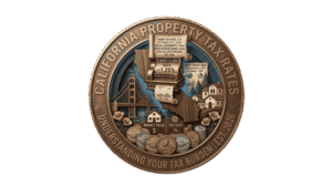
Property Tax Rates

Find Your County Map

County Property News
In Alameda County, California, the County Assessor’s Office manages and updates comprehensive property and parcel data for public use. The county currently tracks approximately 472,000 parcels and 634,000 matched buildings, leveraging GIS property points and validated address records across the region. Property address records were recently updated, identifying around 634,835 secondary addresses, including multi unit and suite identifiers. The Assessor has also standardized zoning data for all 472,000 parcels, supporting accurate property assessments, parcel records, and tax roll information.
Alameda County CA ZIP Codes & Cities
Find homes in popular Alameda County CA ZIP codes or search by city, neighborhood, and region. Browse all ZIP codes and communities across Alameda County California.
About Alameda County CA ZIP Codes
Alameda County California includes major cities and communities such as Oakland, Fremont, Berkeley, Hayward, Alameda, Livermore, Pleasanton, Dublin, Newark, and Union City. This searchable ZIP code directory helps residents, home buyers, property owners, and businesses quickly explore postal areas across Alameda County.
Alameda County, Florida Property Overview 2026
In Alameda County, California, there are approximately 407,237 residential and 22,759 commercial properties. The average single-family home is 68 years old with 1,859 sq. ft. In 2026, 1,554 homes were sold, with 12,462 sales recorded over the past year. About 0.68% of homes are seriously underwater, 50.91% are high value properties, and the effective property tax rate is 0.74%. Foreclosure filings totaled 257 year-to-date.
Residential Properties
410,000+
Commercial Properties
Avg. Home Age Single Family
Avg. Square Feet Single Family
Residential Sales 2026
Homes Seriously Underwater
Residential Sales past year
Rich Homes percentage
Effective 2026 Property Tax
Total Foreclosure Filings 2025
257 Year to Date
Top Cities in Alachua County
The most popular cities in Alameda County, California are Oakland with 140,000 parcels, Berkeley with 50,000 parcels, and Fremont with 60,000 parcels. These cities serve as the county’s primary residential and commercial centers. With diverse neighborhoods, educational institutions, and thriving industries, they play a key role in property assessments, zoning management, and the overall parcel data maintained by the Alameda County Assessor’s Office.

Oakland city
99,590+ Parcels

Berkeley city
29,383+ parcels

463,215 Parcels
Alameda County, CA Property Search Tool Has 4 Best Methods
Our Alameda County, California Property Search Tool makes accessing property records online simple and free. You can search by owner name, parcel number (APN), property address, or city name. Instantly view ownership details, tax records, sales history, and complete property information with just a few clicks.
Search By Owner Name
You Can Use Owner name For Property Search In Alameda County, California.
Search By Address
You Can Also search Property Info with address in Alameda County, California.
Search By Parcel PIN
Use Parcel Number For Exect Search In Alameda County, California.
Search By City Name
If You Dont't have any other Option, search With City Name, Use in Address
Learn How to Use the Alameda County Property Search Tool
Our Alameda County, California. Property Search Tool delivers comprehensive property insights with every search. Search by owner name, parcel number (PIN), or address to access full property records, ownership details, tax information, land values, and official county assessment data everything you need for accurate and informed real estate research.
Zip Code
Streamline your Alameda County property search using our advanced GIS tool. Instantly filter thousands of assessable parcels by Zip Code to unlock precise municipal zoning maps, structural tax roll attributes, demographic trends, and market valuation data across Davis, Woodland, and West Sacramento.
APN
Instantly track any property with our GIS tool using the APN (Assessor’s Parcel Number). This unique identifier allows you to pull up to date tax roll records, assessment valuations, and official municipal boundaries across Alameda County.
Assessor ID
Efficiently track property ownership, structural tax data, and official county records using our GIS search tool. Simply input the Assessor ID to instantly verify ownership history, map layers, and accurate municipal tax assessments across Alameda County.
Roll Year
Analyze valuation trends and verify historical data using our GIS tool. Filter by Roll Year to access the specific fiscal year's assessment records, tracking property tax obligations and changing market values across Alameda County.
Tax Rate Area Code
Identify local taxing jurisdictions instantly using our GIS search tool. Input the Tax Rate Area Code to determine the exact property tax rates applied by city, school, and special districts across Alameda County.
Property Location
Pinpoint any asset instantly using our GIS search tool. Enter the Property Location to verify the physical address, view exact geographic placements, and retrieve official county mapping records across all Alameda County cities.
Property Use Type
Filter parcels instantly by Property Use Type using our GIS search tool. Determine whether a property is classified as residential, commercial, or industrial to analyze its municipal zoning restrictions and accurate tax roll obligations across Alameda County.
Year Built
Analyze building age and market potential using our GIS search tool. Filter by Year Built to instantly verify a structure's construction date, influencing accurate valuation trends, insurance assessments, and historical data across Alameda County.
Square Footage
Compare market values and property size using our GIS search tool. Filter by Square Footage to instantly verify the total living area of a property, helping you analyze municipal tax valuations or calculate renovation costs across Alameda County.
Number of Bedrooms
Filter residential listings instantly by Number of Bedrooms using our GIS search tool. Quickly track total sleeping spaces to assist in precise property valuations, comparative market analyses, and accurate county tax assessments across Alameda County.
Number of Bathrooms
Filter residential parcels instantly by Number of Bathrooms using our GIS search tool. This parameter lets you track essential utility data, refine comparative market analyses, and access accurate property tax valuations across Alameda County.
Number of Units
Filter multi family and commercial parcels by Number of Units using our GIS search tool. Instantly identify the quantity of separate living or commercial spaces on a property to analyze rental income potential, zoning allowances, and precise tax assessments across County.
Land Value
Analyze investment potential using our GIS search tool. Filter by Land Value to isolate the county assessed worth of the parcel raw land alone, enabling accurate property tax calculations and strategic real estate development analysis across Alameda County.
Improvement Value
Evaluate structural worth instantly using our GIS search tool. Filter by Improvement Value to isolate the assessed valuation of buildings and structures on a parcel, helping you calculate total real estate tax liabilities and market prices across Alameda County.
Total Value
Discover a property's full assessed worth using our GIS search tool. Filter by Total Value to instantly view combined land and improvement valuations, ensuring accurate calculation of municipal property taxes and investment returns across Alameda County.
Total Exemption
Maximize tax savings and verify active tax relief using our GIS search tool. Filter by Total Exemption to instantly view any active deductions applied to a parcel's valuation such as Homeowners', Veterans', or Senior Citizens' exemptions helping you track net taxable value and reduced tax obligations across Alameda County.
Taxable Value
Determine exact tax liabilities instantly using our GIS search tool. Filter by Taxable Value to analyze the final net portion of a property's assessed worth that is subject to county taxation after all active exemptions have been subtracted across Alameda County.
Parcel Legal Description
Verify boundary boundaries and property integrity using our GIS search tool. Access the official Parcel Legal Description to retrieve the exact lot, block, tract, or subdivision records essential for real estate transactions, legal verification, and land survey planning across Alameda County.
Street
Locate specific parcels instantly using our GIS search tool. Search by Street to identify a property's exact roadway location, streamline geographic navigation, and retrieve accurate public county records across all Alameda County municipalities.
City
Refine your geographic inquiries using our GIS search tool. Filter by City to instantly pinpoint the specific municipality where a property is located, allowing you to analyze local municipal tax rates, city specific zoning bylaws, and community regulations across Alameda County.
Alameda County Property Tax & Demographic Data
Alameda County city level property and tax data for 2025 to 2026, including estimated parcels, population, land area, effective tax rates, and median property taxes. Note: California does not use a "millage rate" in the traditional sense; instead, it applies a base property tax rate of 1.00% of assessed value (Proposition 13) plus local voter-approved bonds and special assessments.
| City Name | Total Parcels (Est.) | Total Population | Land Area (Sq Mi) | Effective Tax Rate (Est.) | Median Property Tax |
|---|---|---|---|---|---|
| Oakland | 115,000 | 444,839 | 55.9 | 1.35% – 1.45% | $8,800 |
| Fremont | 68,500 | 227,065 | 77.5 | 1.15% – 1.25% | $9,200 |
| Hayward | 46,000 | 156,297 | 45.3 | 1.20% – 1.30% | $5,500 |
| Berkeley | 32,500 | 120,514 | 10.5 | 1.40% – 1.60% | $9,400 |
| San Leandro | 26,000 | 87,400 | 13.3 | 1.20% – 1.30% | $4,800 |
| Livermore | 29,500 | 85,100 | 26.4 | 1.10% – 1.20% | $7,400 |
| Alameda | 21,000 | 78,795 | 10.4 | 1.15% – 1.25% | $7,200 |
| Pleasanton | 24,000 | 77,500 | 24.3 | 1.10% – 1.20% | $9,500 |
| Union City | 19,500 | 68,000 | 19.5 | 1.25% – 1.35% | $6,100 |
| Newark | 14,000 | 48,200 | 13.9 | 1.15% – 1.25% | $6,500 |
| Dublin | 16,500 | 71,200 | 15.2 | 1.20% – 1.35% | $9,100 |
| Albany | 5,800 | 19,600 | 1.8 | 1.50% – 1.80% | $10,200 |
| Piedmont | 3,900 | 11,200 | 1.7 | 1.30% – 1.50% | $15,000+ |
| Emeryville | 3,500 | 12,500 | 1.2 | 1.45% – 1.55% | $8,200 |
Unincorporated Alameda County Data (2025 to 2026)
Unincorporated areas are managed directly by the county rather than city councils. Combined, these areas would form the 4th largest "city" in Alameda County.
| Area Name | Total Parcels (Est.) | Total Population | Land Area (Sq Mi) | Effective Tax Rate (Est.) | Median Property Tax |
|---|---|---|---|---|---|
| Castro Valley | 22,500 | 65,389 | 16.9 | 1.15% – 1.25% | $9,100 |
| San Lorenzo | 8,500 | 29,000 | 2.8 | 1.20% – 1.30% | $5,763 |
| Ashland | 6,200 | 23,000 | 1.8 | 1.25% – 1.35% | $4,200 |
| Cherryland | 4,100 | 15,500 | 1.2 | 1.25% – 1.35% | $3,900 |
| Fairview | 3,800 | 10,500 | 2.8 | 1.15% – 1.25% | $8,400 |
| Sunol | 650 | 950 | 32.1 | 1.05% – 1.15% | $11,500 |
Top 10 Largest Property Owners in Alameda County, California
The top Alameda County property owners include the State of California, Prologis, City of Oakland, East Bay Regional Park District, EBMUD, and major commercial players with extensive parcels and commercial space.
| Rank | Owner Name | Parcel Count / Sq. Ft. | Notes / Location |
|---|---|---|---|
| 1 | State of California | 1,776 parcels | Largest overall landowner |
| 2 | Prologis Inc. | 146 properties, 23.35M sq. ft. | Major hubs in San Leandro & Oakland |
| 3 | City of Oakland | 800+ parcels | Municipal and public use |
| 4 | East Bay Regional Park District | 666 parcels | Conservation & recreation |
| 5 | Alameda County Flood Control | 600 parcels | Infrastructure & water management |
| 6 | East Bay Municipal Utility District (EBMUD) | 590 parcels | Water utility services |
| 7 | Hines | 9.4M sq. ft. | Commercial properties across Bay Area |
| 8 | Alexandria Real Estate Equities | 8.7M sq. ft. | Life science properties |
| 9 | Brookfield Properties | 8.2M sq. ft. | Commercial & mixed-use space |
| 10 | Leland Stanford Jr. University | 470 parcels | Primarily Santa Clara, some in Alameda County |
FAQ's
What information can I find using the Alameda County Property Search Tool?
The Alameda County Property Search Tool lets you locate properties by owner name, parcel number (APN), property address, or city. Instantly access detailed ownership records, tax information, land value, and official county property data.
How do I search for a property?
You can search by owner name, parcel number (PIN), property address, or city name. Simply enter the relevant information in the search tool, and you’ll instantly see the property details.
Is the property information free to access?
Yes, all property data provided through the Alameda County Property Search Tool is completely free for public use. No subscription or payment is required.
How often is the property data updated?
The tool uses official county records, updated regularly to reflect new sales, assessments, and ownership changes, ensuring accurate and up-to-date property information.
Can I use this tool for legal or official purposes?
While the tool provides official county data, it is primarily for research and informational purposes. For legal matters, always verify with official county records or documents.